![]()


![]()
 |
Southwell and Nottingham Church History ProjectAuthor: Dr Christopher Brooke Date: 2000–onwards Application Area: Landscape Geography |
 |
Sir John Vanbrugh and the Vitruvian LandscapeAuthor: Dr Caroline Dalton Date: 2006–2009; 2009–onwards Application Area: Historical Geography |
 |
An analysis of the 19th century tithe maps as an aid to analysing the origins and development of the historic landscapeAuthor: Rodney Lane Date: 2012–ongoing Application Area: Landscape Archaeology |
 |
The Primitive Methodist Connexion - Tackling the MythAuthor: Sandy Calder Date: 2012 |
 |
Green Infrastructure Study of Cheltenham and GloucesterAuthor: David Green Date: 2011 Application Area: Landscape Architecture, Geography |
 |
Edward Street, Ladywood ward, Birmingham, West MidlandsAuthor: Dawn MacQueen Date: 2011 |
 |
Evolution of London's Road NetworkAuthor: Dr Kiril Stanilov |
 |
A GIS-based reconstructive model of the agricultural environment of the South Downs during World War II using aerial photography and the National Farm SurveyAuthor: Dr Kate Taylor |
 |
The Landscape of George Muller's 'New Orphan Houses', Ashley Down, BristolAuthor: Paige Johnson |
 |
Measurement of Historic Coastal Erosion Rates using multi-temporal dataAuthor: Katja Haberland |
 |
Quantification of diffuse sources of mine water pollution in a post-industrial river basinAuthor: Dr Will Mayes, Dr Emma Gozzard, Dr Hugh Potter,
Dr Adam Jarvis |
 |
Geology, Visualization and the 1893 Hauliers' Strike: an Interdisciplinary ExplorationAuthors: Dr Catherine Preston |
 |
The history of fossil collecting in and around Street in SomersetAuthor: Dr Mike A Taylor Date: 2009-ongoing Application Area: Vertebrae Palaeontology, Geology |
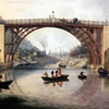 |
The Engineering Geology and Geological Hazards of Ironbridge GorgeAuthor: Giles David |
 |
A GIS for the coastal system at Sandscale Haws Cumbria, derived by using geodata from EDINA, Mimas & third party sourcesAuthor: Amy Laurence |
|
Quantification of diffuse sources of mine water pollution in a post-industrial river basinAuthor: Dr Will Mayes, Dr Emma Gozzard, Dr Hugh Potter,
Dr Adam Jarvis |
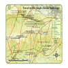 |
Travel and Communication in the Early Medieval Landscape of WessexAuthor: Alexander James Langlands |
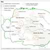 |
A Persistence of Place: A Study of Continuity and Regionality in Roman to Early Medieval Settlement Patterns in Southern Roman BritainAuthor: Fiona Fleming |
 |
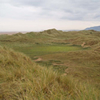
The Stonehenge Riverside ProjectAuthor: Mark Dover, on behalf of the Universities of Bournemouth, Bristol, Manchester, Sheffield and UCL Date: 2002-2012 Application area: Archaeology |
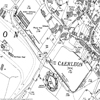 |
Archaeological work at Isca: the Roman legionary fortress at Caerleon, South WalesAuthor: Dr Peter Guest |
 |
East is East and West is West, Class Division in the Sheffield LandscapeAuthor: Peter Brown |
 |
Changing Beliefs: The Archaeology of the East Anglian ConversionAuthor: Dr Richard Hoggett Date: 2007 Application Areas: History and Archaeology |
 |
Walmgate Stray, York - Landscape InvestigationAuthor: Oliver Bullock |
EDINA would like to thank everyone who has contributed their efforts in helping us to collate these Case Studies.
Not found what you are looking for? Please ask a question or give feedback by emailing (digimap@ed.ac.uk) or chatting with the Digimap team.
Share a to this page.
You may also find more information or communicate with us on our Social Media sites:
|
© University of Edinburgh. |