| Data Download Version: |
|
 |
| Download allowance: |
|
|
| Formats Available: | ||
| Version in Roam: | July 2020 (Raster Charts XL) |
|
| View in Roam: | All views |
|
| Terms of Use: | ||
| Copyright Statement: | © British Crown and OceanWise, 2018. All rights reserved. Licence No. EK001-20180802. Not to be used for Navigation. |
|
| Scale: | 1:45,000,000 to 1:10,000 |
|
| Tile Size: | Various, dependent on chart scale |
|
| Example Uses: |
|
|
| Official Information Sources: | ||
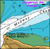
OverviewRaster Charts are derived from raster-based material obtained under licence from the UK, and other, Hydrographic Offices. They provide familiarity for users who work with nautical charts, are pre-symbolised and ready for immediate use. Raster Charts can be opened using any image viewer software and are available as individual charts for different geographic areas at discrete scale levels. Raster Charts are available in two versions: 'Full Marginalia’ and 'XL' (eXcLuding land). The ‘XL’ version has all extra information round the map (e.g. north arrows, scale bars, inset maps etc.) removed and replaced with transparent areas. This makes it ideal for use in GIS software allowing users to pan across adjacent charts without this information obscuring the map data. Horizontal coordinate reference system:
All depths are to Chart Datum, which in most cases is equal to Low Astronomical Tide (LAT) or Lowest Low Water (LLW) depending on location. |
||
| For
more information about the product see the official User Guide: |
||
Additional Information |
||
| Styling Files: | N/A | |
| Printable Legend: | N/A | |
| Sample Data: | N/A | |