| Data Download Version: | March 2020 |
 |
| Download allowance: | No limit |
|
| Formats Available: | ||
| Version in Roam: | May 2018 |
|
| View in Roam: | All views |
|
| Terms of Use: | ||
| Copyright Statement: | © British Crown and OceanWise, 2018. All rights reserved. Licence No. EK001-20180802. Not to be used for Navigation. |
|
| Scale: | ||
| Tile Size: | 30x30km |
|
| Example Uses: |
|
|
| Official Information Sources: | ||
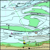
OverviewMarine Themes Vector is an intelligent dataset, it is derived from authoritative material obtained from the UK, and other, Hydrographic Offices, as well as comprehensive source data where available. Marine Themes Vector is engineered into logical data layers for easy loading and efficient use in desktop and web-based Geographic Information Systems (GIS). Data attributes have been designed with analysis and querying in mind. Chart boundaries have been removed to create a seamless, simplified dataset across charts. This dataset is available in GIS compatible file formats. Horizontal Coordinate Reference System: WGS84 (EPSG:4326) All depths are to Chart Datum, which in most cases is equal to Low Astronomical Tide (LAT) or Lowest Low Water (LLW) depending on location. |
||
| For
more information about the product see the official User Guide: |
||
Additional Information |
||
| Styling Files: | A .style file is supplied with all downloads of Marine Themes Vector data which can be used to style the data in ESRI's ArcGIS. The data supplier do not currently supply style files for other GIS applications. |
|
| Printable Legend: | N/A |
|
| Sample Data: | N/A | |