Combining OS MasterMap® Topography Layer with Land-Form PROFILE® Contours in AutoCAD
NOTE: Land-Form PROFILE is now an obsolete product. You should use Terrain 5 instead.
Please see the Autodesk Summary page for details of overlaying other datasets in Autodesk software.
This topic describes the process of overlaying contour information from Land-Form PROFILE® on top of detailed mapping from OS MasterMap® Topography Layer in AutoCAD. Separate instructions are available on how to do this in AutoCAD Map 3D.
It is assumed that you have already downloaded OS MasterMap® Topography Layer in DWG format and Land-Form PROFILE® contours in DXF format for the same area from the Ordnance Survey Data Download service in Digimap. The data should be unzipped and stored in a suitable local or network location.
Convert Land-Form PROFILE® contours to DWG
Open AutoCAD.
Open the Land-Form PROFILE® contours dataset using the Open Drawing dialog. At the select file dialog change the 'files of type' drop down to DXF.
Press Open then on the Navigation Bar select the Zoom Extents button.
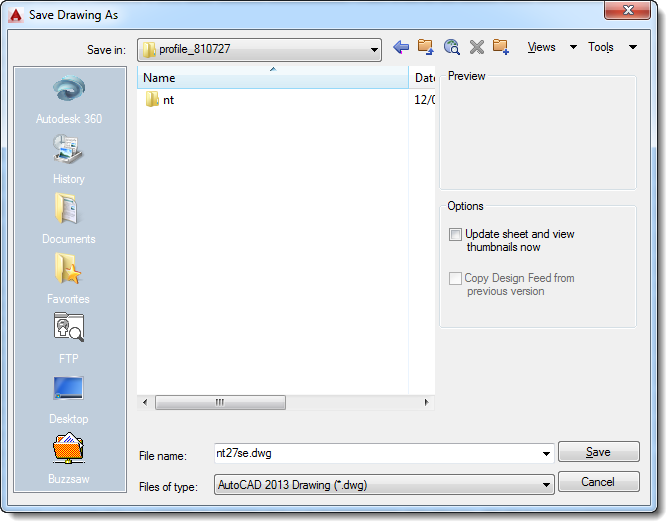
Using the Save as function save the drawing as a new DWG file. On the Save Drawing As dialog ensure that the 'files of type' drop down is set to 'AutoCAD 2013 Drawing (*.dwg)', as shown below:
Repeat steps 2-4 for all other Land-Form PROFILE® contour .dxf tiles that were downloaded.
Close all drawings currently open in AutoCAD.
Display Land-Form PROFILE® contours on top of OS MasterMap® Topography Layer
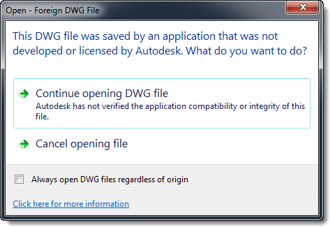
Open the OS MasterMap® Topography Layer DWG file in AutoCAD. At the 'Open - Foreign DWG File' window click 'Continue opening DWG file':
On the Navigation Bar select the Zoom Extents button, the downloaded data will be displayed:
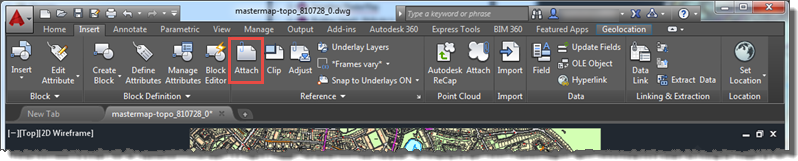
To attach the Land-Form PROFILE® contours dataset go to the Insert tab and click on the Attach button in the Reference section:
At the 'Select Reference File' dialog ensure the 'Files of type' drop down is set to 'Drawing (*.dwg)'
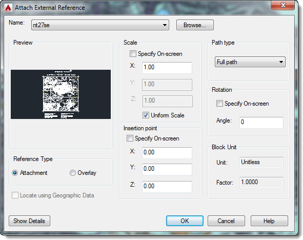
The 'Attach External Reference' dialog will be shown, leave the dialog as it is:
Note the 'Locate using Geographic Data' is greyed out and cannot be selected/deselected. This is because both datasets contain geographic location information so AutoCAD will place the datasets in the correct position.
Repeat steps 3-5 for all Land-Form PROFILE® contour tiles that were converted to DWG format in the first section.
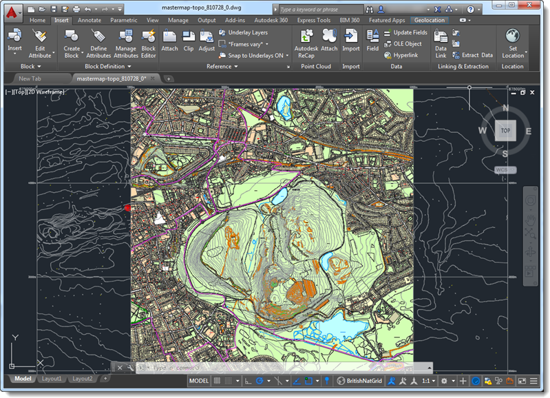
The Land-Form PROFILE® contours dataset will be displayed on top of the OS MasterMap® Topography Layer data:
Customising the map to turn off features that are not required
By default all of the information held in the Land-Form PROFILE® Contours drawing will be shown including information at the edges of each Land-Form PROFILE® tile which will obscure the OS MasterMap® Topography Layer data below it.
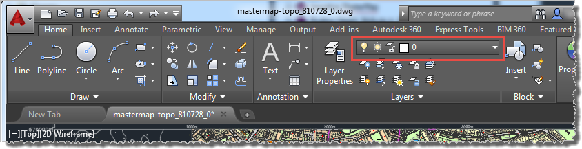
Individual layers are controlled using the dropdown in the Layers section of the Home tab:
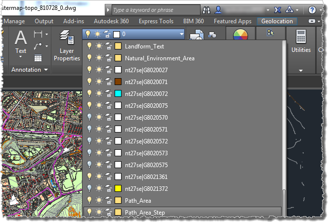
To turn layers off expand the layers dropdown and then click on the lightbulb icon beside the layer(s) you wish to turn off:
The complete list of feature codes in Land-Form PROFILE®Contours is as follows:
G8020027 - Spot Heights
G8020071 - High Water Level
G8020072 - Low Water Level
G8020075 - Contours
G8020570 - Trademark symbols
G8020571 - Footnotes and grid values
G8020572 - Grid lines
G8020573 - Grid lines
G8020575 - Grid values
G8021361 - Index contours
G8021372 - Air heights
To make things clearer try only turning on:
G8020027 - Spot Heights
G8020071 - High Water Level
G8020072 - Low Water Level
G8020075 - Contours
G8021361 - Index contours
Saving your drawing
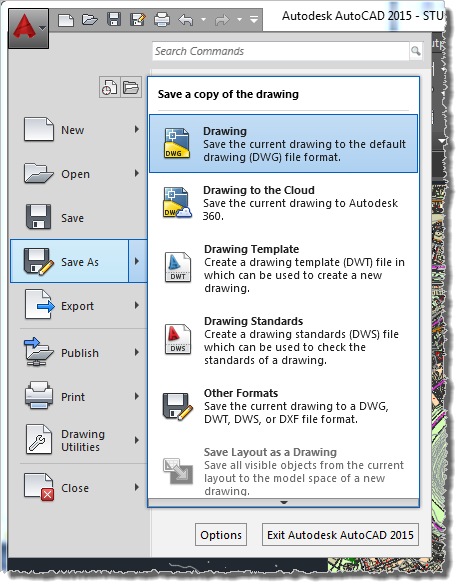
Having customised the drawing it is a good idea to save it through the Save As menu:
Remember to save you file of type: "AutoCAD 2013 Drawing (*.dwg)".