![]()


![]()
| Data Download Version | May 2016 |
 |
|||||||
| Download allowance: | No limit |
||||||||
| Formats Available: | |||||||||
| Version in Roam: | N/A |
||||||||
| View in Roam: | N/A |
||||||||
| Terms of Use: | |||||||||
| Copyright Statement: | Contains Ordnance Survey data © Crown copyright and database right 2020 |
||||||||
| Scale: | 1:10,000 |
||||||||
| Tile Size: | N/A - single dataset covering the whole of Great Britian |
||||||||
| Example Uses: |
|
||||||||
| Official Information Sources: |
|
||||||||
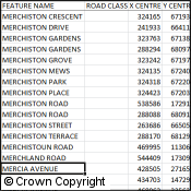
OverviewNote: This dataset is no longer updated. OS Locator™ will be withdrawn by Ordnance Survey as of October 2017. OS Open Names is recommended as a suitable alternative. OS Locator has been designed to allow users to refine searches of road names or numbers by providing additional reference to localities and recognised geographies such as local authority and county. This is essential to overcome the ambiguities associated with quick identification of precise locations based solely on road names or numbers. For example, the name ‘High Street’ is repeated hundreds of times throughout the country, whilst many roads extend for several kilometres without a change to either road name or number. With over a 850,000 entries, OS Locator is a national gazetteer of road names. It enables users to identify and find specific locations by a number of criteria, including locality, settlement, local authority and county. It has been created to compliment Ordnance Survey’s range of mid-scales raster map data products, such as OS Street View®. As a point-based gazetteer of road names, OS Locator does not contain any road geometry although it does contain coordinates to create a rectangle encompassing the extent of the road referenced in the gazetteer, a minimum bounding rectangle. Results of searches can be easily visualised using the gazetteer in conjunction with backdrop mapping products. |
|||||||||
| For more information about the product see the official Ordnance Survey User Guide: |
|||||||||
Additional Information |
|||||||||
| Styling Files: |
|
||||||||
| Printable Legend: | N/A | ||||||||
| Sample Data: | N/A | ||||||||
Not found what you are looking for? Please ask a question or give feedback by emailing (digimap@ed.ac.uk) or chatting with the Digimap team.
Share a to this page.
You may also find more information or communicate with us on our Social Media sites:
|
© University of Edinburgh. |