![]()


![]()
| Data Download Version: | July 2019 |
 |
| Download allowance: | 100 Tiles |
|
| Formats Available: | ||
| Version in Roam: |
N/A |
|
| View in Roam: | N/A | |
| Terms of Use: | ||
| Copyright Statement: | Contains Ordnance Survey data © Crown copyright and database right 2020 |
|
| Scale: | 1:50 000 |
|
| Tile Size: | 10 x 10km |
|
| Example Uses: |
|
|
| Official Information Sources: |
|
|
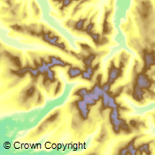
OverviewOS Terrain 50 is a digital terrain model (DTM) for Great Britain. The data enables you to add the third dimension to other datasets in your GIS or perform analysis. The OS Terrain 50 DTM is not used in Digimap Roam. The dataset consists of a grid of height values at 50m horizontal intervals. |
||
| For more information about the product see the official Ordnance Survey User Guide: |
||
Additional Information |
||
| Styling Files: | N/A |
|
| Printable Legend: | N/A | |
| Sample Data: | N/A | |
Not found what you are looking for? Please ask a question or give feedback by emailing (digimap@ed.ac.uk) or chatting with the Digimap team.
Share a to this page.
You may also find more information or communicate with us on our Social Media sites:
|
© University of Edinburgh. |