Green Infrastructure - Case Study
Research title
Green Infrastructure Study of Cheltenham and Gloucester.
Author
David Green.
Project type
Postgraduate research.
Subject
Landscape Architecture.
Related subjects
Archaeology; historic landscapes; ecology; hydrology farming; planning; recreation; transportation.
Datasets
OS MasterMap® Topography Layer; OS 1:10000 Scale Raster; OS Strategi; Landmark historical OS maps.
- Source: Digimap Ordnance Survey Collection; Historic Digimap; Landmap; Data Archive.
- Dates/edictions: Historical maps - Ordnance Survey 1st Edition 6” maps.
- Scale: variable, depending on resolution of the data. Typically 1:10000.
Publishing Institution
Birmingham Institute of Art and Design (part of Birmingham City University).
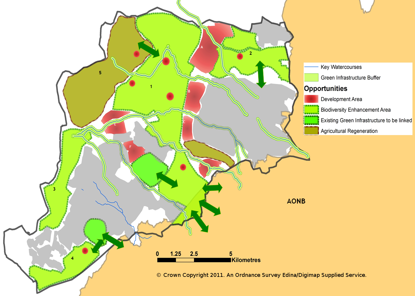
Aims & Objectives
To create a landscape strategy for Cheltenham & Gloucester, specifically to identify opportunities for development and green infrastructure and submit proposals for a landscape design.
Methodology
I used data described above in ArcGIS. The idea was to create a variety of maps for different disciplines – physiographic, ecological, cultural and landscape character. From the analysis I then produced a composite map that graded the landscape sensitivity but also showed opportunities for accommodating development and green infrastructure. Contour data was used to create a 3d topographical hillshade model. Historic maps were used to determine past land use and farming precedent as well as gauging the degree of landscape change over the past 150 years. The maps were useful for looking into the possibilities of reinstating or restoring lost landscapes types such as orchards or woodlands.
Sample map