![]()


![]()
AuthorDr Sue Hearn |
Date2009 |
Project TypePhD |
SubjectConservation Management |
DatasetsName: OS 1: 50,000 scale colour raster, OS Land-form PROFILE DTM 1: 10,000, BGS data 1: 50,000; National Trust estate and compartment boundaries; Phase I; National Vegetation Classification; National Inventory of Woodlands and Trees (NIWT) 2ha woodland dataset; Aerial photography |
Related SubjectsEnvironmental studies; Ecology; Forestry; |
|
Sources: EDINA Digimap; National Trust; Countryside Council for Wales; Countryside Council for Wales; Forestry Commission; Millennium map - Getmapping plc Dates/Editions: Variable, see above. Scales: Variable, see above. |
Key WordsNational Vegetation Classification; Common Standards Monitoring; Vegetation mapping |
Publishing InstitutionSchool of Environment, Natural Resources and Geography, Bangor University, Wales |
|
SummaryThe amount of between-observer variation in maps prepared using the National Vegetation Classification (NVC) and in assessments produced using approaches to Common Standards Monitoring (CSM), both commonly used systems in the UK, were examined VC mapping produced unacceptability high levels of between-observer variation, with average spatial agreement between seven surveyors of only 34.2%. CSM approaches were shown to produce inconsistent results, with major implications for reporting against national condition targets. Quantitative methods utilising systematically located plots were also investigated. Quantitative and qualitative approaches require unfeasible levels of efforts to detect meaningful sizes of change with sufficient power. This leads to the following recommendations: a) Vegetation mapping is unsuitable for monitoring change and should only be used to assess state with full acknowledgment of its subjectivity and uncertainty. Condition assessment could provide widespread snapshots of condition, but should not be used for monitoring temporal change without some quantifiable controls. b) Quantitative methods must include i) a priori definition of the minimum (or threshold) change that should be detected, ii) relative importance of type I and II error rates and iii) definition of sample population and sampling frame which specifically includes consideration of spatial heterogeneity. Research should focus on the development of a multi-scale and nested quantitative sampling design which could address monitoring and surveillance questions in the UK. Since resources do not permit universal application of this approach, quantitative data from a small number of sites could be used via diagnostic test methodology (as used in medicine to assess the accuracy of screening tests) to validate widespread condition assessment. |
|
Results/OutcomeHearn, S.M. Perspectives in vegetation monitoring: an evaluation of approaches currently used in the UK. Diss. PhD thesis, School of Environment, Natural Resources and Geography, Bangor University, 2009. |
|
References & AcknowledgementsSupervisor: Dr Morag McDonald, Bangor University; Professor Tom Healey, Bangor University; Dr Jenny Wong, Wild Resources Limited, a North Wales based environmental consultancy group. Part-funded by the European Social Funding initiative and Wild Resources Limited. |
|
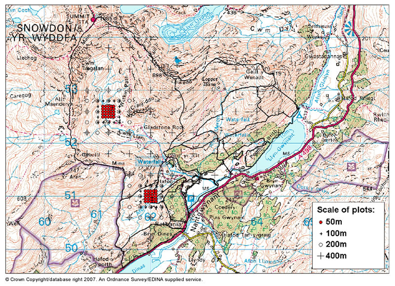 |
Map 1: This map shows Hafod y Llan in Snowdonia, which stretches from the oak woodlands in the Nant Gwynant valley up to the summit of Snowdon. The locations of sample plots across grids at a variety of scales are shown. |
|
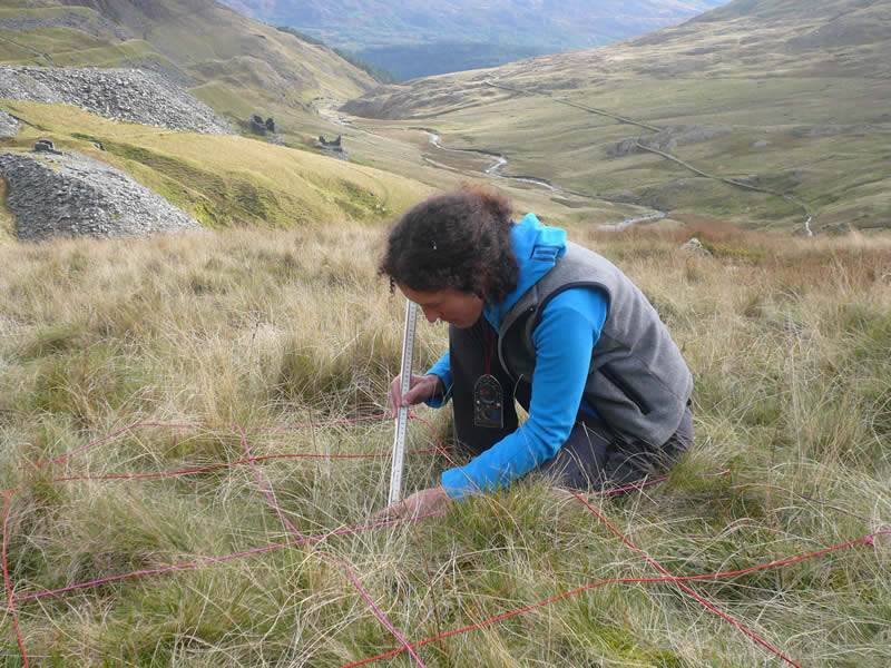
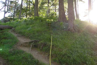
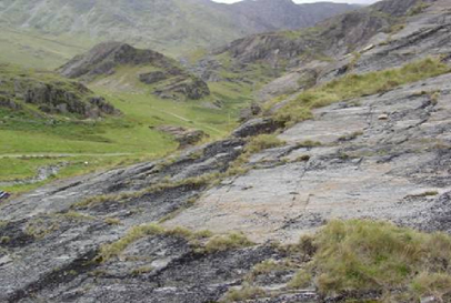
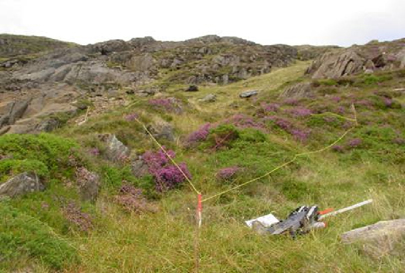
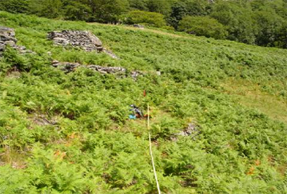
Photos of plots in a variety of habitats across Hafod y Llan: |
|
 |
|
 |
|
 |
|
 |
|
Not found what you are looking for? Please ask a question or give feedback by emailing (digimap@ed.ac.uk) or chatting with the Digimap team.
Share a to this page.
You may also find more information or communicate with us on our Social Media sites:
|
© University of Edinburgh. |