Digimap is an EDINA service delivering maps and map data to UK Higher
and Further Education comprising the most comprehensive maps and geospatial
data available. The data is available to generate maps online, and to
download for use with appropriate application software such as GIS or
CAD. The data is made available in a series of Collections, described
below. To see which collections your institution subscribes to please
visit the subscription
list.
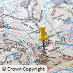 Ordnance Survey Ordnance Survey
The Ordnance Survey collection contains a number of datasets
ranging from small scale base maps, such as MiniScale®,
to detailed large scale mapping including OS MasterMap®,
which is the most detailed large scale vector dataset available
from Ordnance Survey. Complete coverage of Great Britain is available
for all the products in the collection and all products are updated
throughout the year, as and when updates are received from Ordnance
Survey. |
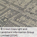 Historic Historic
Explore past landscapes and visualise change through time with
Historic Digimap. Access to scanned maps of Great Britain dating
back to 1840 with the ability to view maps from different times
side-by-side making visual comparisons easy. The historic map
collection is extensive, however map series rarely provide complete
coverage of Great Britain. |
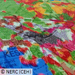
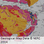 Geology Geology
Geology Digimap provides map data at a number of different scales
from the British Geological Survey (BGS) along with the BGS Lexicon
of Named Rock Units and the Onshore Borehole Index. |
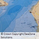 Marine Marine
Access the most detailed spatial data and marine charts for
the waters around Great Britain. Marine charts provide detailed
information about both offshore and near-shore areas while the
vector data accessible through Marine Digimap is the most detailed
data available describing our coastal environments and includes
gridded bathymetry, socioeconomic and conservation layers. |
 Environment Environment
Environment Digimap provides Land Cover Maps of Great Britain
and Northern Ireland from the Centre for Ecology and Hydrology
(CEH). The data is available in raster and vector format
for a number of different years. |
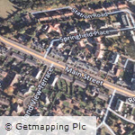 Aerial Aerial
Aerial Digimap provides high resolution (25cm) vertical aerial
imagery data of Great Britain from Getmapping Plc. The data is
provided in raster format for use in GIS and CAD applications. |
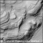 Lidar Lidar
Lidar Digimap provides digital terrain models, digital surface
models, point cloud data and vertical aerial photography. The
data is available to download for use in GIS and CAD applications. |
 Global Global
Global Digimap provides access to global datasets, including
OpenStreetMap and Natural Earth. |


