![]()


![]()
| Data Download Version | June 2013 |
 |
| Download allowance: | 200 tiles |
|
| Formats Available: | ||
| Version in Roam: | N/A |
|
| View in Roam: | N/A |
|
| Terms of Use: | ||
| Copyright Statement: | © Crown copyright and database rights 2020 Ordnance Survey (100025252) |
|
| Scale: | 1:10,000 |
|
| Tile Size: | 5 x 5km |
|
| Example Uses: |
|
|
| Official Information Sources: |
|
|
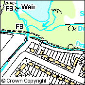
OverviewNote: Ordnance Survey withdrew the 1:10,000 Raster dataset on 31 March 2014. This dataset is no longer updated. 1:10,000 Raster data, as its name suggests, is a raster dataset. The 1:10,000 Raster data is image data and so individual features cannot be removed from the dataset. Each tile covers 5km x 5km and there are 10,568 edge matched tiles which cover Great Britain. 1:10 000 Scale Raster is typically used to create and plot high-quality maps for producing site plans, web services showing locations, creating maps for use in reports and presentations and providing geographic context for your own data.
|
||
| For more information about the product see the official Ordnance Survey User Guide: |
||
Additional Information |
||
| Styling Files: | N/A | |
| Printable Legend: | ||
| Sample Data: | ||
Not found what you are looking for? Please ask a question or give feedback by emailing (digimap@ed.ac.uk) or chatting with the Digimap team.
Share a to this page.
You may also find more information or communicate with us on our Social Media sites:
|
© University of Edinburgh. |