| Data Download Version | January 2020 |
 |
| Download allowance: | No limit |
|
| Formats Available: | ||
| Version in Roam: | January 2020 |
|
| Views in Roam: | National View, Regional View, County View |
|
| Terms of Use: | ||
| Copyright Statement: | Contains Ordnance Survey data © Crown copyright and database right 2020 |
|
| Scale: | 1:1,000,000 |
|
| Tile Size: | One tile covering Great Britain |
|
| Example Uses: |
|
|
| Official Information Sources: |
|
|
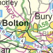
OverviewOrdnance Survey's MiniScale is a small-scale product, nominally at 1:1 million scale, providing simple backdrop mapping covering the whole of Great Britain. |
||
| For more information about the product see the official Ordnance Survey User Guide: |
||
Additional Information |
||
| Styling Files: | N/A | |
| Printable Legend: | N/A | |
| Sample Data: | Click here for a larger sample image of MiniScale® | |