| Data Download Version: | April 2020 |
 |
|||||||||||
| Download allowance: | No limit |
||||||||||||
| Formats Available: | |||||||||||||
| Version in Roam: | April 2020 |
||||||||||||
| View in Roam: | Neighbourhood View, Street View, Detailed View |
||||||||||||
| Terms of Use: | |||||||||||||
| Copyright Statement: | Contains Ordnance Survey data © Crown copyright and database right 2020 |
||||||||||||
| Scale: | 1:10,000 |
||||||||||||
| Tile Size: | 100 x 100km |
||||||||||||
| Example Uses: |
|
||||||||||||
| Official Information Sources: |
|
||||||||||||
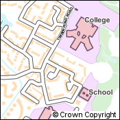
OverviewOS Open Map - Local is the most detailed street-level open data vector mapping product available and is a great backdrop over which to display and analyse your own data. OS Open Map - Local is suitable for the following applications:
|
|||||||||||||
| For more information about the product see the official Ordnance Survey User Guide: |
|||||||||||||
Additional Information |
|||||||||||||
| Styling Files: |
** Additional style files exist for GML data loaded in to Oracle and PostGIS using GO Loader from Snowflake Software: these can be found here. |
||||||||||||
| Printable Legend: |
N/A |
||||||||||||
| Sample Data: | N/A | ||||||||||||