![]()


![]()
| Data Download Version: | April 2020 |
 |
| Download allowance: | No limit |
|
| Formats Available: | ||
| Version in Roam: | N/A |
|
| View in Roam: | N/A |
|
| Terms of Use: | ||
| Copyright Statement: | Contains Ordnance Survey data © Crown copyright and database right 2020 |
|
| Scale: | 1:25,000 |
|
| Tile Size: | 20 x 20km |
|
| Example Uses: | OS Open Names is a comprehensive list of:
|
|
| Official Information Sources: |
|
|
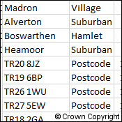
OverviewOS Open Names lists definitive place names, roads numbers and postcodes in Great Britain – 2.5 million accurate locations. The key features are below:
|
||
| For more information about the product see the official Ordnance Survey User Guide: |
||
Additional Information |
||
| Styling Files: | N/A |
|
| Printable Legend: |
N/A |
|
| Sample Data: | N/A | |
Not found what you are looking for? Please ask a question or give feedback by emailing (digimap@ed.ac.uk) or chatting with the Digimap team.
Share a to this page.
You may also find more information or communicate with us on our Social Media sites:
|
© University of Edinburgh. |