![]()


![]()
| Data Download Version: | April 2020 |
 |
| Download allowance: | 400 tiles |
|
| Formats Available: | ||
| Version in Roam: |
N/A |
|
| View in Roam: | N/A | |
| Terms of Use: | ||
| Copyright Statement: | © Crown copyright and database rights 2020 Ordnance Survey (100025252) |
|
| Scale: | 1:10,000 |
|
| Tile Size: | 5 x 5km |
|
| Example Uses: |
|
|
| Official Information Sources: |
|
|
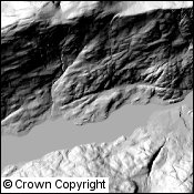
OverviewOS Terrain 5 is a digital terrain model (DTM) for Great Britain. The data enables you to add the third dimension to other datasets in your GIS or perform analysis. The OS Terrain 5 DTM is not used in Digimap Roam. The dataset consists of a grid of height values at 5m horizontal intervals which are calculated at the centre of the pixel. |
||
| For more information about the product see the official Ordnance Survey User Guide: |
||
Additional Information |
||
| Styling Files: |
|
|
| Printable Legend: | N/A | |
| Sample Data: | N/A | |
Not found what you are looking for? Please ask a question or give feedback by emailing (digimap@ed.ac.uk) or chatting with the Digimap team.
Share a to this page.
You may also find more information or communicate with us on our Social Media sites:
|
© University of Edinburgh. |