| Data Download Version | June 2006 |
 |
| Download allowance: | 100 tiles |
|
| Formats Available: | ||
| Version in Roam: | N/A |
|
| View in Roam: | N/A |
|
| Terms of Use: | ||
| Copyright Statement: | Contains Ordnance Survey data © Crown copyright and database right 2020 |
|
| Scale: | 1:50,000 |
|
| Tile Size: | 20 x 20km |
|
| Example Uses: |
|
|
| Official Information Sources: |
|
|
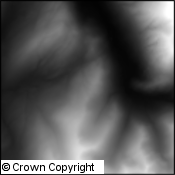
OverviewNote: Land-Form PANORAMA has been withdrawn by Ordnance Survey and is no longer updated. Land-Form PANORAMA has been superseded by OS Terrain™ 50. Land-Form PANORAMA is a digital representation of the contours from Ordnance Survey's 1:50 000 scale Landranger maps. It is available in two forms: as Contours and as a Digital Terrain Model. The Ordnance Survey has used the dataset to derive mathematically a digital terrain-model (DTM). The dataset consists of a grid of height values interpolated from the contour data at 50m horizontal intervals. Height values are rounded to the nearest metre. Accuracy varies according to the complexity of the terrain, and is around half of the Land-Form PANORAMA contour interval. |
||
| For more information about the product see the official Ordnance Survey User Guide: |
||
Additional Information |
||
| Styling Files: | N/A | |
| Printable Legend: |
N/A |
|
| Sample Data: |
N/A |
|