![]()


![]()
| Data Download Version | November 1993 |
 |
|||||||||||
| Download allowance: | 100 tiles |
||||||||||||
| Formats Available: | |||||||||||||
| Version in Roam: | N/A |
||||||||||||
| View in Roam: | N/A |
||||||||||||
| Terms of Use: | |||||||||||||
| Copyright Statement: | Contains Ordnance Survey data © Crown copyright and database right 2020 |
||||||||||||
| Scale: | 1:50,000 |
||||||||||||
| Tile Size: | 20 x 20km |
||||||||||||
| Example Uses: |
|
||||||||||||
| Official Information Sources: |
|
||||||||||||
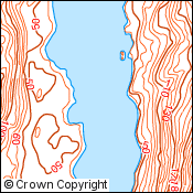
OverviewNote: Land-Form PANORAMA has been withdrawn by Ordnance Survey and is no longer updated. Land-Form PANORAMA has been superseded by OS Terrain™ 50. Land-Form PANORAMA is a digital representation of the contours from Ordnance Survey's 1:50 000 scale Landranger maps. It is available in two forms: as Contours and as a Digital Terrain Model. Contours are at 10 metre vertical intervals together with breaklines, lakes, coastline and a selection of spot heights to the nearest metre. Digital contour accuracy values are typically better than 3 metres root mean square error. |
|||||||||||||
| For more information about the product see the official Ordnance Survey User Guide: |
|||||||||||||
Additional Information |
|||||||||||||
| Styling Files: |
|
||||||||||||
| Printable Legend: |
N/A |
||||||||||||
| Sample Data: | |||||||||||||
Not found what you are looking for? Please ask a question or give feedback by emailing (digimap@ed.ac.uk) or chatting with the Digimap team.
Share a to this page.
You may also find more information or communicate with us on our Social Media sites:
|
© University of Edinburgh. |