![]()


![]()
| Data Download Version | November 2009 |
 |
|||||||||||
| Download allowance: | 400 Tiles |
||||||||||||
| Formats Available: | |||||||||||||
| Version in Roam: | N/A |
||||||||||||
| View in Roam: | N/A |
||||||||||||
| Terms of Use: | |||||||||||||
| Copyright Statement: | © Crown copyright and database rights 2020 Ordnance Survey (100025252) |
||||||||||||
| Scale: | 1:10,000 |
||||||||||||
| Tile Size: | 5 x 5km |
||||||||||||
| Example Uses: |
|
||||||||||||
| Official Information Sources: |
|
||||||||||||
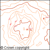
OverviewNote: Land-Form PROFILE has been withdrawn by Ordnance Survey and is no longer updated. Land-Form PROFILE has been superseded by OS Terrain™ 5. Land-Form PROFILE provides detailed height data surveyed at a scale of 1:10,000. The dataset is available as Contours and as a Digitial Terain Model (DTM). Contours are at 5 metre vertical intervals and 10 metre vertical intervals in some mountain and moorland areas. The dataset also includes air heights, spot heights, and high and low water marks. Digital contour accuracy values are typically better than half the contour interval, that is ±2.5 metres for areas with 5 metre vertical intervals and ±5 metres for areas with 10 metre vertical intervals. |
|||||||||||||
| For more information about the product see the official Ordnance Survey User Guide: |
|||||||||||||
Additional Information |
|||||||||||||
| Styling Files: |
|
||||||||||||
| Printable Legend: | N/A | ||||||||||||
| Sample Data: | |||||||||||||
Not found what you are looking for? Please ask a question or give feedback by emailing (digimap@ed.ac.uk) or chatting with the Digimap team.
Share a to this page.
You may also find more information or communicate with us on our Social Media sites:
|
© University of Edinburgh. |