| Data Download Version: | 1999-2006 |
 |
| Download allowance: | 100 tiles |
|
| Formats Available: | ||
| Version in Roam: | N/A |
|
| View in Roam: | N/A |
|
| Terms of Use: | ||
| Copyright Statement: | © Crown copyright and database rights 2020 Ordnance Survey (100025252) |
|
| Scale: |
|
|
| Tile Size: | Varying tile sizes depending on local detail:
|
|
| Example Uses: |
|
|
| Official Information Sources: |
Further information can be found on archived OS Land-Line page of The National Archives. |
|
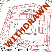
OverviewLand-Line was the flagship detailed topographic product from Ordnance Survey for a number of years. It was superseded by OS MasterMap® Topography Layer and was withdrawn by OS in September 2008. The Land-Line family of products comprised two separate versions:
Digimap supplies the Land-Line.Plus® product. Land-Line.Plus® data is ideal for individuals wishing to undertake longitudinal studies that examine the change in areas over time. |
||
| For more information about the product see the official Ordnance Survey User Guide: Land-Line User Guide (v5.2 – 04/2004) |
||
Additional Information |
||
| Styling Files: | None available at present. |
|
| Printable Legend: |
N/A |
|
| Sample Data: | N/A | |