| Data Download Version | May 2020 |
 |
|||||||||||
| Download allowance: | 8 Tiles |
||||||||||||
| Formats Available: | |||||||||||||
| Version in Roam: | May 2020 |
||||||||||||
| View in Roam: | Local View, Neighbourhood View |
||||||||||||
| Terms of Use: | |||||||||||||
| Copyright Statement: | Contains Ordnance Survey data © Crown copyright and database right 2020 |
||||||||||||
| Scale: | 1:25,000 |
||||||||||||
| Tile Size: | 100 x 100km |
||||||||||||
| Example Uses: |
|
||||||||||||
| Official Information Sources: |
|
||||||||||||
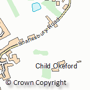
OverviewOS VectorMap District is a flexible cartographic vector product that enables you to overlay your own information. It is a mid-scale vector OpenData product from the Ordnance Survey with a nominal scale of 1:25,000 and is recommend for display between 1:15,000 and 1:35,000. There are 55 tiles each covering 100 x 100km, file sizes vary between 1 and 697Mb. The majority of content derived from the mid-scales database, however Buildings, cartographic text and functional sites are derived from large-scale database. The dataset includes features in the following categories: Buildings; Roads; Surface Water; Boundaries; Railways; Public Amenities; Heritage Sites; Woodland; Rock Outcrops; Power Lines; Place Names; and Spot Heights. NOTE: There is also a Raster version available from Data Download. |
|||||||||||||
| For more information about the product see the official Ordnance Survey User Guide: |
|||||||||||||
Additional Information |
|||||||||||||
| Styling Files: |
** Additional style files exist for ShapeFile data loaded in to Oracle and PostGIS using GO Loader from Snowflake Software: these can be found here. |
||||||||||||
| Printable Legend: | |||||||||||||
| Sample Data: | N/A | ||||||||||||