![]()


![]()
| Data Download Version | May 2020 |
 |
| Download allowance: | 100 Tiles |
|
| Formats Available: | ||
| Version in Roam: | May 2020 |
|
| View in Roam: | District View, Local View |
|
| Terms of Use: | ||
| Copyright Statement: | Contains Ordnance Survey data © Crown copyright and database right 2020 |
|
| Scale: | 1:25 000 |
|
| Tile Size: | 10 x 10km |
|
| Example Uses: |
|
|
| Official Information Sources: |
|
|
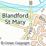
OverviewVectorMap District Raster is a mid-scale mapping product for Great Britain that is part of the Ordnance Survey's OpenData range. There are 2860 tiles each covering 10 x 10 km and ranging from 2 to 6.3 Mb in size. The Raster Data is available in to different versions, Full Colour and Faded Colour. The faded version is useful as a backdrop map to other datasets whereas the full colour version can be used as a stand alone cartographic map. Both versions are in GeoTiff format and so are ready to open in GIS software without the need for additional spatial referencing. This information can be lost if you open the Tiff files in older graphics packages. The dataset includes feature from the following categories: Buildings; Roads; Surface Water; Boundaries; Railways; Public Amenities; Heritage Sites; Woodland; Rock Outcrops; Power Lines; Place Names; and Spot Heights. NOTE: There is also a Vector version available from Data Download.
|
||
| For more information about the product see the official Ordnance Survey User Guide: |
||
Additional Information |
||
| Styling Files: | N/A | |
| Printable Legend: | ||
| Sample Data: | N/A | |
Not found what you are looking for? Please ask a question or give feedback by emailing (digimap@ed.ac.uk) or chatting with the Digimap team.
Share a to this page.
You may also find more information or communicate with us on our Social Media sites:
|
© University of Edinburgh. |