Data Download applications
Introduction
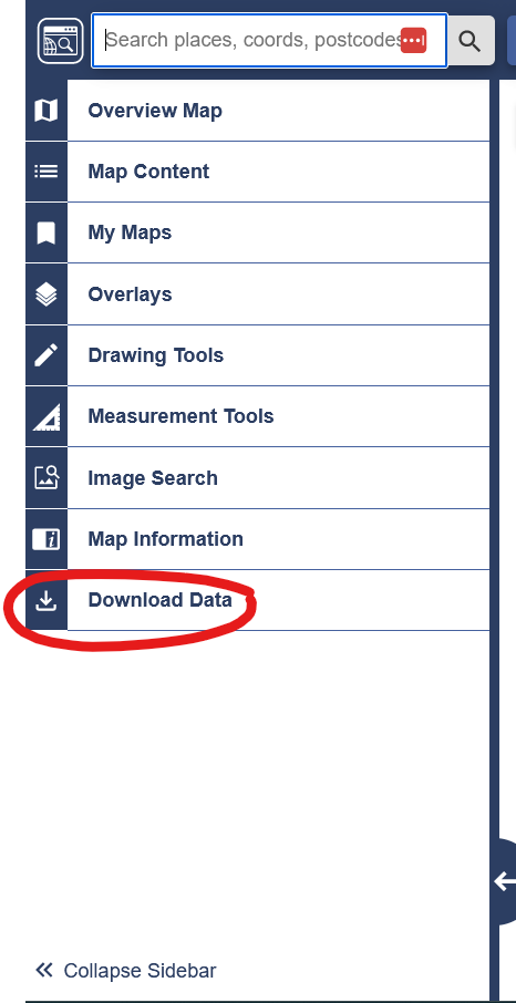
Our Download Data function offers download of geospatial data for your location. You can download data for your chosen collection using the download data tab in the left hand panel. Since August 2023, mapping and data download functions have been combined and are no longer separate applications within each Digimap Collection.

Downloading data is a straightforward 4 step process. NOTE: Typically you will require additional software to view or analyse the data downloaded from Digimap Collections, e.g. GIS or CAD software.
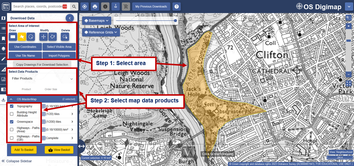
Step 1 Select area
You must define your area on the map - several tools are available to help you do this. These are at the top of the left hand panel.
Step 2 Select map data products
- The next step is to select the map data products you require, from the categories in the left hand panel. Note that you can use the grid icon to show the area availability of a dataset. For tiled datasets, the number of tiles contained within your chosen area of interest will also be shown. These will be in red if your area of interest contains more than the allowance per download.
- Select Add to basket.

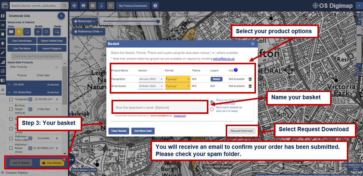
Step 3 Your basket
Basket options
Options vary between data products, but you may be able to select; version, format, theme and/or layers. Check our Product Options page for more details.
Request download

Step 4 Download completed order
- When your order is ready, Digimap Collections will send you a second email. Please check your spam folder.
- Select the download link in this email to access your data.
Help video
Select the image below or this text to view our short video.